Status: Completed
Start date: 1 July 2024
Completion date: 31 March 2026
Project code: M-209
Species/Threats: Weeds
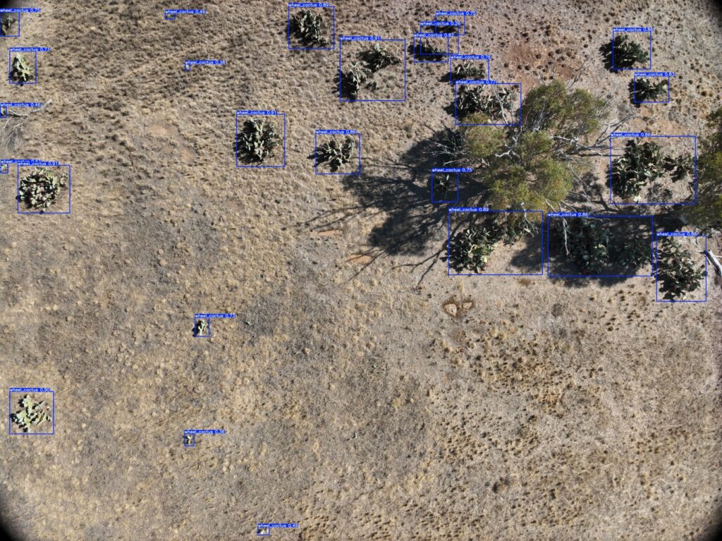
Now commercialised, the WeedRemeed platform uses drones equipped with camera to take images of native plant and weed species.
WeedRemeed™ uses advanced colour picking and Artificial Intelligence (AI) and Machine Learning (ML) technology to identify and locate important native plants and weed species.
The objectives of this project are to:
The project received funding from the Australian Government Department of Climate Change, Energy, the Environment and Water Saving Native Species Program (Threat innovation grants).
WeedRemeed continues to scale up using drones, machine learning and AI to identify weeds in complex landscapes,
Trials have been completed at four sites across the ACT, NSW and Victoria, while upcoming trials are planned for Edgbaston Reserve (QLD) and Hiltaba (SA) next month.
The WeedRemeed project successfully developed a YOLOv5-variant object detector model for wheel cactus which achieved a detection rate of 84% and kept false positives below 13%.
This trial at Buckrabanyule provided a great insight into the capacity of the system and how beneficial it can be to management programs.